
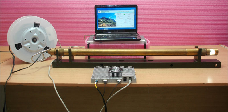
VTTVSS Tele Visual Survey System
Tele-Visual Survey System measures various parameters and provides situation awareness to understand the environmental conditions and geographical parameters of human remote places like deep bore holes, forests, undersea etc for Disaster management, Mining, Border security maintenance and Sea Exploration. The system can communicate the data up to a distance of 10KM. The Televisual Survey system consists of a Probe (placed at a remote location), Data Acquisition Unit, and display unit with GUI.
Features:
- Replacement of the existing offline instruments
- Online identification of bore well structure/defects/cavities/formations
- Real time identification of minerals & fluids while drilling
- Identification of objects at remote inaccessible locations like collapsed mines/buildings or any other structures
- Rescue operation for accidents in bore wells or mines
- Locates concentration of fish/shrimp in ocean water to aid fishermen and deep sea survey
- Online measurement of various parameters like azimuth, elevation, bank angle etc with time stamp
- No data loss-high bandwidth video data transmission and reliable video storage media with replay facility
- Metallic sturdy water tight enclosure for high pressure and temperature environment.
- To record and exchange real time or offline surveillance data
- To Enhance Situation Awareness
- It helps to identify the underwater cracks of the DAM from a remote point with clear picture and location details